
Walking a Corinth Street Directory by Address
A Corinth address search begins with the location, not a name. Full-address USPS lookup helps normalize a delivery line. Next, the CAD result supplies a property ID and legal description. The county GIS places that parcel among roads, city limits, and other public layers. After that, an official-records search can tie the legal description to recorded instruments. The final step is to label each name by its role instead of treating all results as occupants.
- Enter the full Corinth address in USPS and keep the returned city label, ZIP, and any unit separate from the Corinth base address.
- Search Denton CAD by Corinth address to capture the situs, property ID, legal description, and appraisal owner or filing name.
- Open Denton County GIS and compare the Corinth parcel with roads, municipal-boundary, and cadastral layers.
- Use the Corinth legal description, subdivision, lot, block, grantor, or grantee in Official Records, then read the recorded image.
- Add the appropriate Corinth city permit, concern, historical-directory, or county historical source only after the parcel and date are clear.
Corinth’s postal page names 76208 and 76210 as city-assigned ZIP Codes, but a ZIP result is delivery geography, not proof of a city boundary or of a person at the address.
Normalize Corinth Street Records
Keep the original input as well as a normalized form. Useful fields are house number, directional prefix, street name, street type, directional suffix, unit, city label returned by USPS, ZIP, property ID, subdivision, lot, and block. If a search is blank, try the address without a directional or street type, test a numbered road with a spelled-out version where the portal allows it, and try both Corinth and Denton as postal labels.
Corinth’s historic postal wrinkle matters here. The city’s 2018 materials document that some 76210 addresses could appear with Denton as the postal last line. Preserve what the original record says. Then compare the current city GIS, county GIS, CAD city field, and full-address USPS result. A map layer, a postal line, and a legal boundary are different answers to different questions.
- Corinth situs address
- The physical Corinth property location used in appraisal or tax records.
- Corinth parcel
- A mapped Corinth land unit tied to a property ID or legal description.
- Corinth plat
- A recorded Corinth map that identifies a subdivision, lot, block, and related land detail.
- Corinth criss-cross directory
- A historical Corinth directory section arranged by street and address rather than by surname.
Note: A Corinth USPS result identifies delivery geography, while city and county maps answer separate municipal and parcel questions.
Denton CAD Fields for Corinth Addresses
The Denton CAD property search connects a Corinth address to the appraisal parcel. It accepts address, owner name, and property ID. Its documented advanced fields include abstract or subdivision, neighborhood, block, lot, class, city, school district, state code, year, ordering, and direction. CAD also exposes values, improvements, land segments, appraisal notices, deed-history links where available, and map access. Record the property ID before opening a secondary tab.
| CAD field | Street-directory use | How to read it |
|---|---|---|
| Corinth address or situs | Find the appraisal parcel for a Corinth street location | Test a normalized Corinth variation when the first search is blank |
| Corinth owner name | Locate a Corinth appraisal owner or filing field | It is not proof of Corinth current occupancy |
| Corinth property ID | Return to the same Corinth parcel across notes and links | Keep the Corinth retrieval date with the ID |
| Corinth subdivision, block, lot | Bridge a Corinth street address to plats and deeds | Confirm Corinth wording in the recorded image |
| Corinth city, school, and year | Review Corinth appraisal geography and timing | Do not turn those fields into a Corinth municipal-boundary decision |
The CAD schema says parcel geometry is updated or exported weekly, while owner records can lag during annual notification and review periods. Certain confidential ownership and over-65 exemption detail is excluded from public downloads. A field that is missing online is not a finding that the underlying fact does not exist.
The Denton CAD parcel service below documents the parcel layer used for the location side of a Corinth address search.
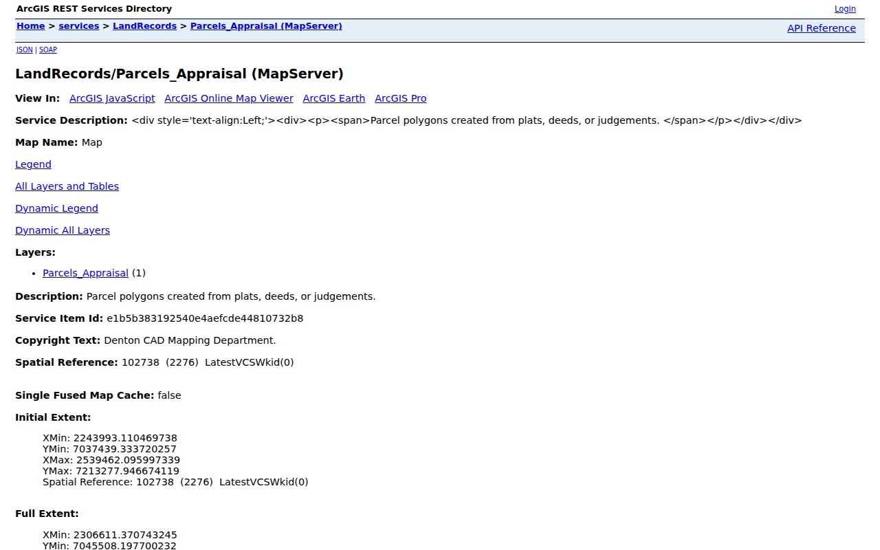
The service exposes geometry and a property link. Use the CAD portal for the appraisal owner field and the County Clerk index for the recorded instrument.
Note: The Corinth parcel layer supplies geometry, but its property link does not identify every person connected to that location.
Corinth Address Situs and Mailing Lines
Tax and CAD searches answer related but different address questions. The Denton County tax search provides account number, owner name, owner address, property location, account type, inactive yes or no, and paid or unpaid status. Its help text describes owner address as a mailing address and property location as the actual site address, without street type or directional. That distinction is unusually useful for a by-address search.
A mailing address can belong to an entity, fiduciary, attorney, office, or other correspondence contact. CAD may show an appraisal owner or filing name. A permit can identify an applicant or contractor. Each is a record role. Use phrases such as “tax mailing address” and “appraisal owner field” in the log, and avoid turning either into a claim that a person lives on a Corinth street.
Deed Instruments Behind Corinth Addresses
The Denton County Official Records advanced search is the deed and plat route for a Corinth street address. It accepts Party Names, Grantor, Grantee, recorded and instrument-date ranges, document types, document number or range, book-volume-page, lot, block, legal description, remarks, and image or full-text phrase fields. Search legal description and subdivision variants, then open the image. A quick-search index line is a lead, not the final instrument reading.
For a title chronology, capture the current legal description from CAD, find the recorded instrument, copy the prior grantor and legal wording, and repeat backward. Search Plats as a separate department because a plat can establish a street, lot, block, or easement before a current address is stable. The portal’s observed certification notice should be rechecked live because coverage and image access vary.
The official-records advanced-search screen below shows the field groups available for an address and legal-description trail.
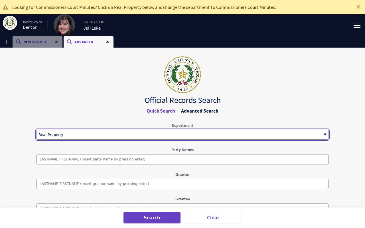
Recorded date and instrument date can differ. Keep both when a Corinth street record is being arranged into a timeline.
Corinth Street Directory Records by Address
These address-keyed sources form the practical Corinth address-record chain. Each record has a defined keeper and a defined limit. The parcel record leads to land facts, the map places geometry, a deed describes an instrument, and city systems provide municipal activity. For a historical street result, the county structure-history route adds directories, clippings, photographs, and oral-history leads after the legal description is known.
| Address-keyed source | Custodian | What it can show | Access route |
|---|---|---|---|
| Corinth CAD property record | Denton CAD | Corinth property ID, situs, appraisal owner field, values, and improvements | Online Corinth address, owner, or ID search |
| Corinth County GIS and parcel layer | Denton County and CAD | Corinth parcel geometry, roads, city limits, precincts, and public layers | Interactive Corinth map and bounded parcel view |
| Corinth Official Records and Plats | Denton County Clerk | Corinth parties, dates, legal descriptions, instruments, and images where available | Corinth quick or advanced search, then image review |
| Corinth permit and inspection material | City of Corinth | Corinth municipal project and inspection history | Corinth Civic Access, eTRAKiT, phone, or city request route |
| Corinth structure and local-history collections | Denton County Office of History and Culture | Corinth clippings, photographs, oral histories, and dated context | Corinth Research Room or transcript request |
Note: A complete street search preserves a source URL, retrieval date, property ID, legal description, indexed name, and stated uncertainty for every hit.
Corinth Permit System Cutover
Municipal files add activity dates to a Corinth address trail. Planning and Development says Civic Access handles new permits and plans from March 27, 2025. Older permit material follows a separate city or eTRAKiT route. The eTRAKiT portal lists Permits, Projects, Contractors or Applicants, Properties, Inspections, Licenses, Violations, CRM Issues, and Contacts. Search the normalized address and compare the dates with CAD and deed dates.
For an older record that is not visible online, Building Services can route permit-search, inspection-scheduling, contractor-registration, and fee-schedule questions. A focused written request to the City Secretary can seek a defined city-held record, including date range and address. The online request, mail, and email route are documented by the city. A request over $40 receives a cost estimate; the ten-business-day guidance concerns a response or notice, not guaranteed production.
Permit, concern, or code material documents municipal activity. It does not prove an individual lived at the location.
Corinth ZIP Labels for Address Records
Use a full-address postal result before treating a Corinth ZIP as part of a street search. The city assigns 76208 and 76210 to Corinth, but it does not publish a street-by-street ZIP or neighborhood split. The 76210 Denton label documented in city material is a reason to search both postal variants in an archive or records index. It is not proof that the location lies outside Corinth.
For a boundary question, compare four layers: the city GIS for services and limits, Denton CAD for parcel and situs fields, Denton County GIS for municipal-boundary context, and USPS for the delivery line. The City Secretary is responsible for the official boundary description and map. Ask that office for the description when a legal boundary, annexation, or disannexation issue remains unresolved.
Note: A Denton postal label for a Corinth 76210 address is a documented archival variant, not a city-limit decision.
Historical Corinth Address Leads
Historic address work should start from the legal description and then move both backward and forward. The Denton County structure-history guide calls for the address, current owner, legal description, addition, lot, block, and GIS location before searching photographs, clippings, newspapers, and directories. That process is safer than assuming a modern street label appears unchanged in an older source.
TSLAC lists Denton city-directory volumes, not a standalone Corinth series. A directory can supply a dated name, address label, spouse notation, occupation, telephone entry, or home and room notation, but it cannot prove title. The historical shelf itself is covered on the Corinth city directory page. For street work, keep the directory’s city and year beside the exact address form.
No official source reviewed documented a citywide street-renaming or address-renumbering program. A 2018 council item concerning the 100 Block of Lake is a lead for deeper records review, not proof of a completed citywide change.
Corinth Parcel-First House History
Corinth’s Taylor Log Cabin offers a useful record pattern. Denton County says the structure originated in Corinth in the 1860s, remained with descendants until 1992, and was later restored at the Historical Park. Its trail runs through place history, county materials, and a public destination rather than through a citywide name roster. The same approach can help with a particular structure: parcel, legal description, instrument, old address label, then local collection.
When an old street record says Denton and a current map says Corinth, retain both terms. Corinth incorporated in 1960, and postal labels can differ from city limits. If a parcel was divided, a later address may describe only one descendant parcel. The legal description and map geometry decide whether the record chain is continuity, subdivision, or merely nearby context.
Limits of Corinth Address Records
Corinth address records can identify address-keyed information, but they cannot supply a complete or current household roster. CAD and tax records distinguish parcel and mailing relationships. A recorded deed names parties to an instrument. A permit identifies a municipal file role. A historical directory is a dated publication with its own coverage. Protected addresses, redactions, and record gaps also mean an empty result is not a statement that a person has no connection to Corinth.
For a block-level parcel question, map the actual geometry first. A side parcel, rear parcel, common area, drainage tract, road, or easement can change what “next door” means in a street-by-street result.